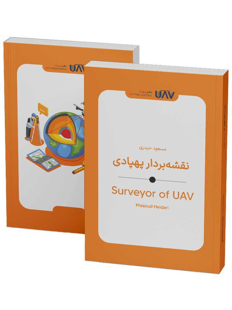
Book – Surveyor of UAV
UAV Publications proudly presents “Surveyor of UAV,” authored by Masoud Heidari — a comprehensive guide to the field of aerial surveying using drones. Written in a straightforward yet scholarly style, this book explores the processes, technologies, software, and contemporary applications of UAV-based surveying.
From photogrammetry to point cloud processing, from precision agriculture to urban monitoring, this work demonstrates how UAVs can revolutionize civil, environmental, and infrastructure projects. The surveyor of UAVs serves not only as a practical and insightful resource for engineers, students, and surveying professionals, but also for anyone intrigued by the potential of drone technology.
With real-world examples, forward-looking insights, and accessible content, this book bridges the gap between cutting-edge innovation and the practical demands of the field. Published by UAV Publications — the world’s first dedicated drone publishing house.
Introduction to the Book Surveyor of UAV
The book “Surveyor of UAV” by Masoud Heidari is a comprehensive and practical resource in the field of aerial surveying using UAVs, published in 2024 by UAV Publications. This book aims to introduce modern technologies in the field of surveying, particularly photogrammetry techniques, the application of various sensors, and specialized software for processing aerial data. The author has strived to present the tools and applications of UAV surveying in a scientific yet accessible language, making it easier for readers to familiarize themselves with the subject. The book’s content is not only valuable for specialists in this field but also for students, construction project managers, urban planners, and enthusiasts of aerial technologies.
The Surveyor of UAV is not just a technical manual, but also a bridge between technology and real-life applications. Throughout the reading, the audience will learn how an unmanned aerial vehicle can collect precise data about the land at minimal cost, contributing to urban development, smart agriculture, crisis management, and the protection of cultural heritage.
Who Should Read This Book?
Surveyor of UAV is written for a wide range of readers. Students and graduates of surveying, civil engineering, urban planning, and geography can benefit from its content for practical learning and a deeper understanding of the concepts. This book can also serve as a supplementary textbook or even a reference in university courses and specialized workshops.
Additionally, professionals working in industries such as agriculture, mining, construction, and infrastructure development will find this work particularly useful. UAV operators, contractors in civil projects, environmental managers, and even GIS professionals can familiarize themselves with standards, methods, and the latest technologies in this field by reading this book. For anyone interested in entering the world of UAVs and their advanced applications, this book serves as an excellent starting point. Its step-by-step structure, explicit language, and practical examples make the learning process easier to understand.
What is UAV Surveying?
UAV surveying is one of the most advanced methods for collecting spatial data, performed using UAVs equipped with high-precision cameras and specialized sensors. In this method, the UAV flies over the target area and captures aerial images from various angles, providing the necessary data to generate accurate 2D maps and 3D models. What makes this technology unique is its speed, accuracy, and lower cost compared to traditional surveying methods. Especially in remote areas or large-scale projects, UAVs play a significant role in optimizing the surveying process.
History and Evolution of UAV Surveying
The use of UAVs in surveying began in the early 2000s. Initially, these tools were primarily used for military and surveillance applications. However, as civilian technologies expanded, UAVs became accessible tools for engineers, researchers, and contractors. The first civilian applications of UAVs were in agriculture and environmental monitoring. Over time, companies such as senseFly, Parrot, and DJI have developed UAVs designed explicitly for surveying. This led to major projects, such as surveying Switzerland’s national park and assessing earthquake-damaged areas in Haiti.
UAV Surveying Technologies
UAV surveying combines a range of hardware and software technologies. On the hardware side, various flight platforms, including fixed-wing UAVs and multirotors, along with RGB cameras, LiDAR sensors, multispectral, and thermal sensors, are utilized. These devices are typically combined with precise GPS units and Inertial Measurement Units (IMUs) to ensure more accurate outputs. On the software side, tools like Pix4D, DroneDeploy, and Agisoft Metashape are used for photogrammetry, ArcGIS for spatial data analysis, and CloudCompare for point cloud processing.
Benefits of UAV Surveying
UAV surveying offers numerous advantages, making it a popular choice for many industries. Some of these benefits include:
- High Accuracy: The ability to produce high-resolution maps with centimeter-level accuracy.
- Speed: Field operations that once took weeks can now be completed in hours.
- Cost-Effectiveness: Less expensive than traditional methods, with no need for heavy equipment or a large workforce.
- Access to Difficult Areas: UAVs can fly over mountainous regions, densely populated urban areas, or hazardous zones.
- Up-to-Date Data: UAVs allow for periodic and regular data collection from a specific area.
Types of UAV Surveying
UAV surveying can be conducted in various ways, depending on the project’s specific requirements. The main types of UAV surveying include:
- Cadastral Surveying: Creating accurate maps for land registration and urban planning with high precision.
- Volume Calculation for Earthworks: Using 3D models to estimate the volume of excavated or deposited materials.
- Real Orthophoto Generation: Creating accurate vertical images used for base maps of cities or infrastructure.
- Digital Elevation Modeling (DEM): Generating DEM, DTM, and DSM for engineering and environmental projects.
- Topographic Maps: Drawing contour lines and other terrain features with high precision.
UAV Surveying Process
The UAV surveying process is a precise sequence of planning, execution, data collection, processing, and analysis. It typically starts with flight planning, where the operator determines the flight path, altitude, image overlap, and sensor type based on the target area. Then, data collection follows, where the UAV flies along the predetermined route, capturing the necessary images or data. In many professional projects, Ground Control Points (GCPs) are used to increase accuracy.
The next stage is data processing, where the collected data is converted into orthomosaics, 3D models, topographic maps, or other outputs using software such as Pix4D or Agisoft Metashape. Following that, the extracted information enters the analysis phase, and finally, the final report is generated based on the data analysis.
Sensors Used in UAV Surveying
The accuracy of UAV surveying largely depends on the type of sensor used on the UAV. Therefore, selecting the appropriate sensor according to the project’s needs is a critical decision. Common sensors include:
- RGB Cameras: Capture high-resolution color images suitable for generating orthophotos and 3D models.
- Multispectral Sensors: Capture data beyond visible light and are used for monitoring vegetation health and crop management.
- Thermal Sensors: Capture temperature variations and are used in energy inspections, agriculture, and rescue operations.
LiDAR (Light Detection and Ranging): Utilizes laser pulses to measure distance, enabling the creation of highly accurate 3D point clouds; ideal for terrain modeling in vegetated areas or with high precision requirements.
Each of these sensors has its specific application, depending on the budget, required accuracy, and type of project.
Software for Processing UAV Surveying Data
Processing data obtained from UAV surveying is impossible without specialized software tools. These tools fall into two main categories:
- Photogrammetry Processing Software.
- Geospatial and GIS Analysis Tools.
In the first category, software such as Pix4D, Agisoft Metashape, and DroneDeploy processes images to generate orthomosaics, 3D models, and point clouds. These tools are easy to use and typically produce high-precision outputs. In the second category, software such as ArcGIS, QGIS, and CloudCompare is used for spatial data analysis, measurement, classification, modeling, and generating practical reports. By combining both categories of software, it is possible to extract useful, analyzable, and decision-making data from the initial images.
Diverse Applications of UAV Surveying in Various Industries
The application of UAV surveying technology extends far beyond one industry. It has had a significant impact across various fields. Key applications include:
- Precision Agriculture: Monitoring crop health, identifying damaged areas, and optimizing water and fertilizer usage.
- Construction and Infrastructure: Monitoring construction projects, assessing structures, and calculating volumes for excavation or filling.
- Environmental Management: Surveying forests, monitoring erosion, assessing water resources, and supporting conservation efforts.
- Mining: Calculating the volume of minerals, assessing slope stability, and generating accurate topographic maps.
- Urban Planning: Creating 3D urban models, analyzing population density, and designing urban transportation routes.
These applications are continually expanding, with new fields emerging every day.
Successful Examples of UAV Surveying Worldwide
In many parts of the world, UAVs have played a crucial role in surveying projects. Some notable examples include:
- The Great Wall of China: UAVs were used to produce accurate maps and 3D models of this ancient structure, providing valuable data for conservationists and historians.
- Hurricane Harvey, USA (2017): UAV surveying was used to assess flood-affected areas and assist relief organizations.
- The Pyramids of Egypt (2011): The most accurate 3D model of the Giza Pyramids was created using fixed-wing UAVs, revolutionizing the field of archaeology.
- Singapore Smart Nation Project: Complete 3D surveying of the city to optimize urban services and infrastructure.
- Wildlife Conservation in Africa: UAVs equipped with multispectral cameras were used to track animal movements, monitor habitats, and combat illegal poaching.
These examples highlight the effectiveness of this technology in diverse scenarios.
Regulations, Legal Requirements, and Safety Considerations
UAV surveying, while offering significant opportunities, also requires adherence to a set of regulations, standards, and safety requirements. In many countries, UAV operations, particularly those involving commercial activities, are regulated by designated authorities. Typical regulations include obtaining pilot licenses, registering UAVs, adhering to altitude restrictions, and ensuring flights remain within the operator’s line of sight. Key safety considerations include:
- Flight Safety: Thorough equipment checks, forecasting weather conditions, and avoiding crowded areas to prevent accidents or interference.
- Privacy: Unauthorized flights over private properties or sensitive locations are prohibited.
- Environmental Protection: Avoid disturbing wildlife or operating in protected areas without the necessary permits.
Understanding the legal framework of each country is essential for professional and ethical UAV surveying.
Current Trends and Future Developments in UAV Surveying
UAV surveying technology is not only expanding across industries but is also rapidly evolving and improving. In recent years, the global market for this industry has reached billions of dollars, and this upward trend is expected to continue.
Some of the key developments and future trends include:
- Integration with Artificial Intelligence: Enabling faster, more accurate data processing and even automated decision-making.
- Beyond Visual Line of Sight (BVLOS) Operations: Developing UAVs capable of flying beyond the operator’s line of sight for surveying large areas.
- 5G Networks: Enabling faster data transmission and real-time access to images.
- Swarm Technology: Deploying multiple UAVs simultaneously to increase speed and coverage for large projects.
- Quantum Sensors: Revolutionizing surveying accuracy with the ability to detect details even in low-light or obstructed conditions.
These developments are shaping the future of the industry, demonstrating that UAV surveying is not just a supplementary tool but a key element in decision-making and resource management.
What Will We Learn from the Book Surveyor of UAVs?
Surveyor of UAV by Masoud Heidari, published by UAV Publications, is one of the most comprehensive and practical Persian resources on aerial surveying using UAVs. This book, written in technical yet comprehensible language, introduces the principles, tools, technologies, and applications of UAV surveying, guiding readers step-by-step through the essential topics in this field.
The book is divided into three main sections:
- Fundamentals and Types of UAV Surveying.
- Applications, Technologies, and Software Tools.
- Real-World Examples, Regulations, Future Trends, and Challenges.
Key features of this work include its comprehensive coverage, practical examples, software analysis, global trends, and attention to the latest innovations. This book is recommended for surveying professionals, students, researchers, and anyone interested in modern surveying technologies.
Why is UAV Surveying a Future-Oriented Knowledge?
The integration of UAV technology with surveying science has created a bridge that breaks down geographical, financial, and temporal barriers. There is no longer a need for months of time and heavy expenses to create accurate maps of remote areas or analyze environmental changes. A few minutes of flight and a set of intelligent tools can provide data that was previously difficult to obtain.
The applications of UAV surveying extend beyond engineering and construction, reaching areas such as environmental protection, natural resource management, rescue operations, archaeology, and even security. This technology is not just an ecological analysis tool but a foundation for strategic decision-making in the future. In this path, awareness, education, and mastery of UAV surveying knowledge will be the key advantage for tomorrow’s specialists.
| Book Author | |
|---|---|
| Book Edition |
First |
| Book Isbn |
978-622-94448-6-3 |
| Book Language | |
| Book Publish Year | |
| Book Pages |
64 |
| Book Publisher |


