A Comprehensive Guide to Understanding LiDAR in UAV Applications
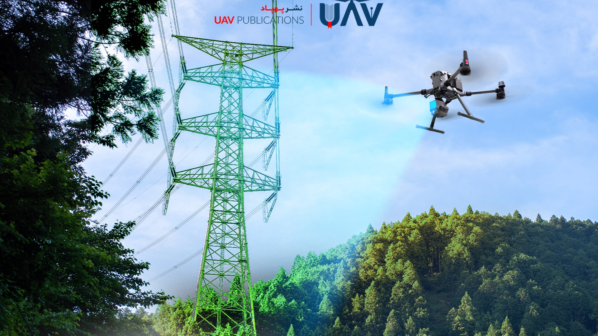
LiDAR (Light Detection and Ranging) technology is increasingly being utilized in the world of UAVs, becoming a vital tool for mapping, 3D modeling, and environmental analysis. Through the use of laser pulses, LiDAR collects highly accurate data from the Earth’s surface and surrounding objects, generating precise 3D models. Integrating LiDAR with UAVs not only significantly enhances mapping accuracy but also dramatically improves data acquisition efficiency.
This comprehensive guide explores the fundamentals of LiDAR technology, its operational mechanisms within UAV systems, its wide range of applications across various industries, and the challenges it may present. We will also highlight the advantages and limitations of LiDAR, providing practical insights on how to incorporate this technology into various types of projects effectively. This guide is particularly valuable for professionals seeking to integrate cutting-edge technologies into their workflows.
What Is LiDAR?
LiDAR stands for Light Detection and Ranging. It is a remote sensing method that uses laser pulses to measure distances between the sensor and objects. By emitting thousands of laser pulses per second and detecting their reflections, LiDAR systems generate precise 3D representations of the surrounding environment. Unlike photogrammetry, which relies on ambient light and image analysis, LiDAR operates independently of lighting conditions, providing reliable performance even in low-light scenarios or at night.
Initially developed for aerospace and military applications, LiDAR has more recently been adapted for use in UAVs, revolutionizing the field of aerial surveying through its enhanced accuracy and reliability. This technology is now a primary tool in projects that require high precision, vegetation penetration, or the detection of ground features hidden beneath surface cover. LiDAR is widely applied in forestry, precision agriculture, urban planning, archaeology, civil engineering, and natural resource management.
The Science and Technology Behind LiDAR
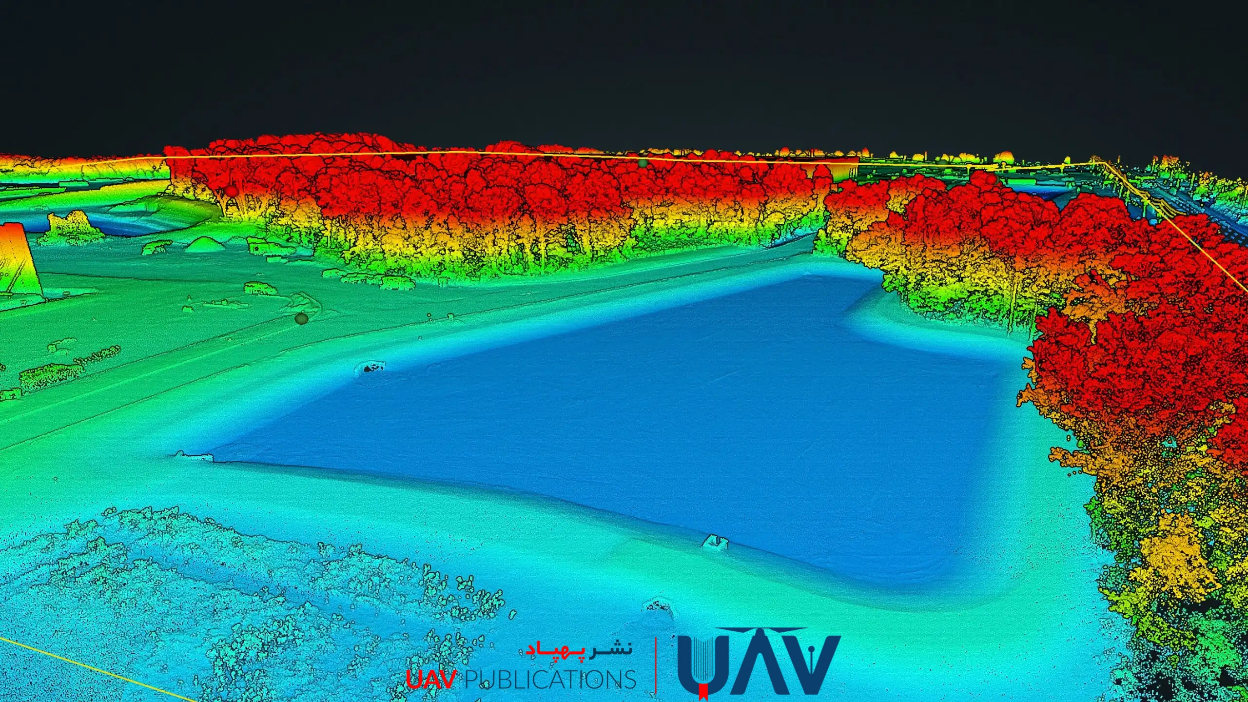
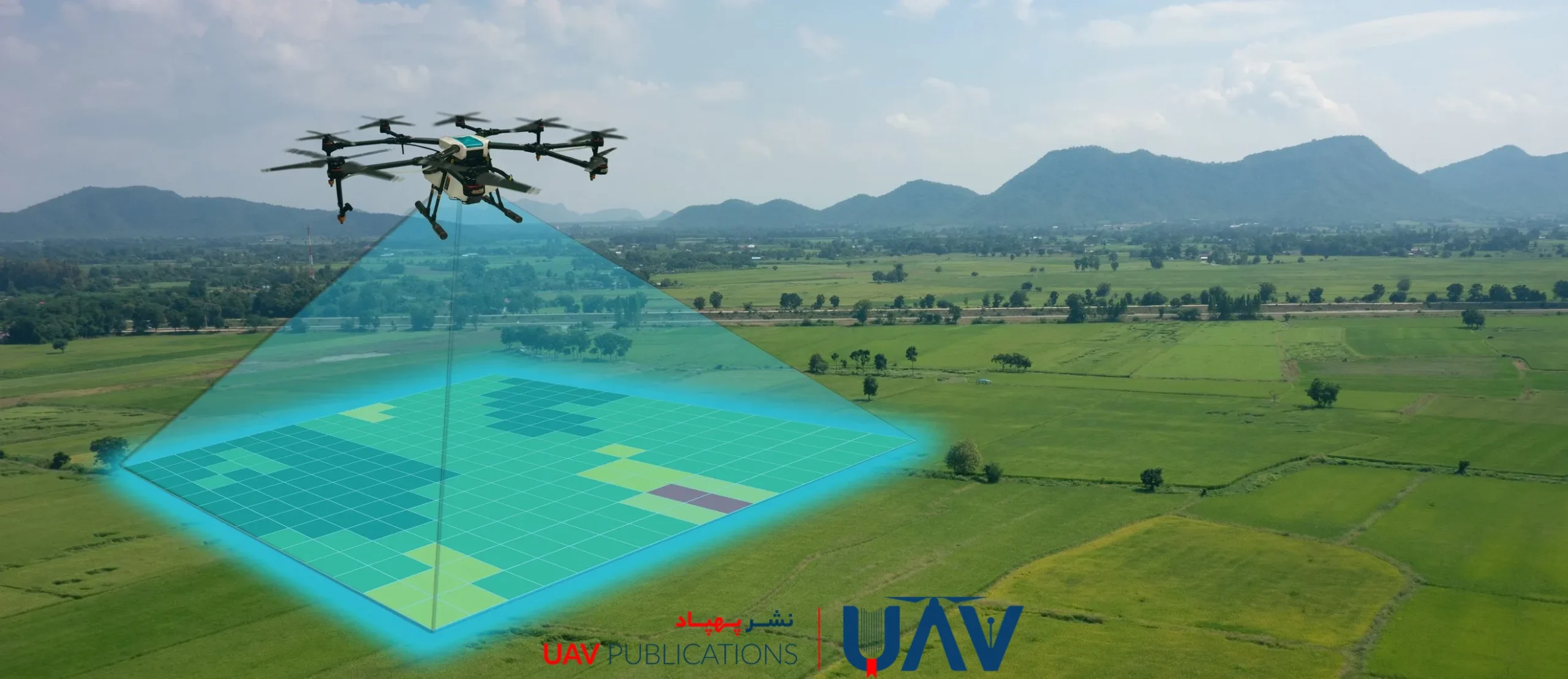
LiDAR operates on a simple principle of light physics: measuring the time it takes for a laser pulse to travel to a target and return. The LiDAR system emits rapid laser pulses toward the ground or surrounding objects. Upon hitting a surface, each pulse is reflected and captured by a receiver. By accurately calculating the time interval between emission and reception, the system determines the exact distance to the object. Each contact point is recorded as a 3D coordinate (X, Y, Z), and the resulting dataset—known as a point cloud—serves as the basis for detailed 3D modeling.
To make these coordinates globally accurate, LiDAR systems are typically integrated with high-precision GPS (often RTK-enabled) and an Inertial Measurement Unit (IMU). The GPS provides the UAV’s geospatial position, while the IMU captures its orientation and movement. This data fusion enables the accurate positioning of each laser pulse, offering unmatched precision that sets LiDAR apart from other imaging techniques.
How LiDAR Is Used in UAVs
The integration of LiDAR into UAV platforms has transformed the landscape of spatial data acquisition. Previously, LiDAR systems were mounted on aircraft or specialized vehicles—expensive and logistically complex solutions. Today, thanks to the miniaturization and affordability of LiDAR sensors, UAVs can effectively carry this technology.
The primary advantage of using LiDAR-equipped drones lies in their ability to capture highly accurate elevation data and 3D representations of terrain. Unlike cameras that may be obstructed by foliage, LiDAR laser pulses can penetrate through vegetation to reach the actual ground surface—an essential feature for applications in forestry, utility line inspection, construction, and mountainous terrain surveys. UAVs can also be programmed for autonomous flights along predefined paths, enabling systematic and efficient data collection across large areas within minutes.
LiDAR vs. Photogrammetry in UAV Applications
LiDAR and photogrammetry both aim to generate 3D models, yet they employ fundamentally different approaches and produce distinct results. Photogrammetry relies on overlapping 2D images and complex image-processing algorithms to reconstruct 3D models. Its accuracy depends on lighting conditions, image quality, and the software used for processing.
LiDAR, by contrast, calculates exact distances through the travel time of laser pulses, functioning independently of ambient light. In dense vegetation, photogrammetry typically captures only the canopy, whereas LiDAR can penetrate foliage to capture the true ground surface, producing Digital Terrain Models (DTMs). LiDAR also functions effectively at night or in cloudy conditions. However, photogrammetry is significantly less expensive and sufficient for projects where centimeter-level accuracy is not essential. The choice between the two technologies depends on the specific project requirements, environmental conditions, budget, and the desired level of accuracy.
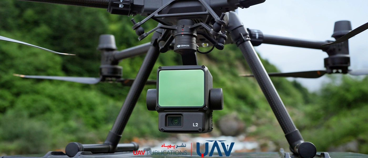
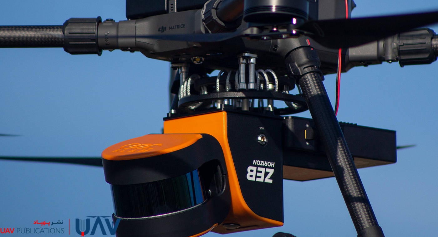
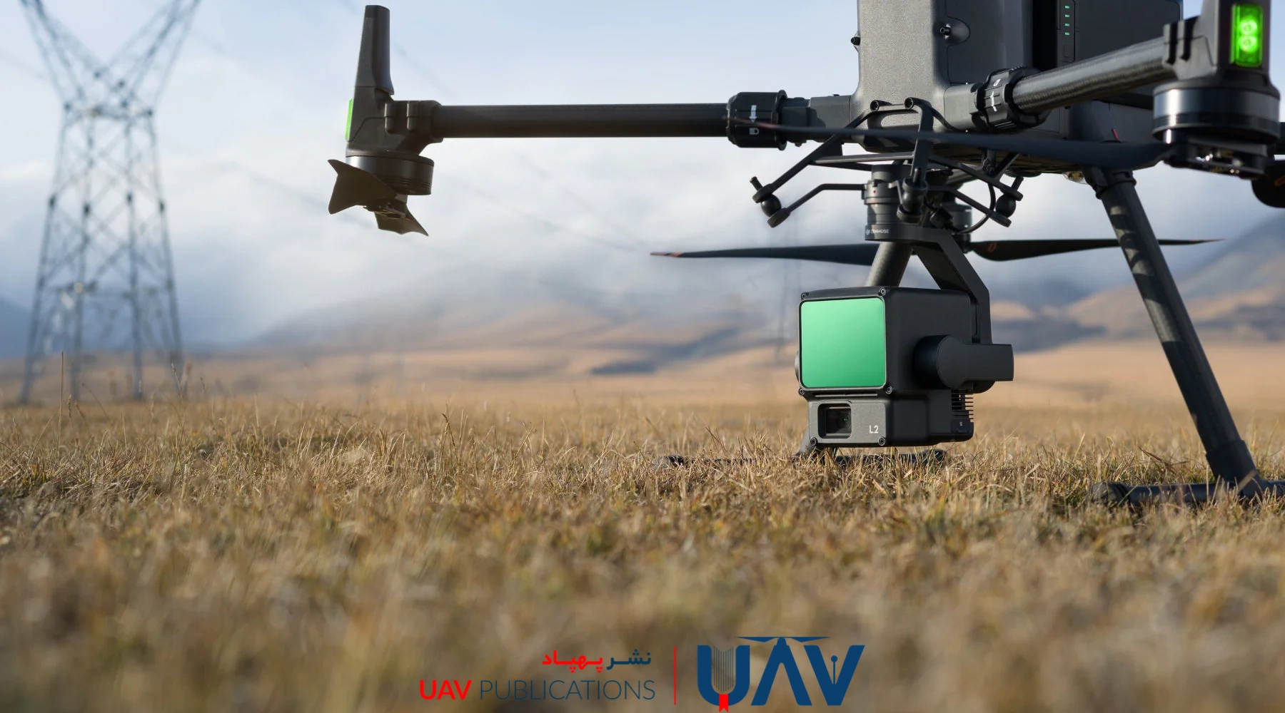
Core Components of a LiDAR System: From Laser to GPS
A UAV-based LiDAR system comprises several key components, each essential to its operation:
- Laser Emitter: Sends high-frequency laser pulses toward the surface. These sensors vary in precision and are selected based on project requirements and environmental conditions.
- Laser Receiver: Detects the returning laser pulses and transmits the reflected data for processing. High sensitivity is crucial for accurately calculating distances.
- GPS Module: Provides the UAV’s precise geolocation. When paired with an RTK-capable GPS, it ensures sub-meter accuracy.
- IMU (Inertial Measurement Unit): Captures the UAV’s movement and orientation, essential for aligning point cloud data spatially.
- Processor: Converts raw point data into usable 3D models and maps by analyzing reflection timing and signal intensity.
Together, these components enable the acquisition of highly detailed and accurate spatial data.
Factors Affecting LiDAR Measurement Accuracy
LiDAR is renowned for its high measurement accuracy, but several factors influence its performance:
- Sensor Quality: Higher-grade sensors offer greater precision, capturing finer details but at a higher cost.
- Flight Altitude: Lower flight altitudes result in higher data accuracy due to shorter laser pulse travel times.
- Environmental Conditions: Vegetation density, atmospheric conditions (such as fog or rain), and surface reflectivity can affect data accuracy. While LiDAR is generally robust, adverse conditions can reduce pulse return strength and compromise accuracy.
Understanding and mitigating these variables is essential to achieving optimal results.
Industry Applications of LiDAR
LiDAR serves as a critical tool across many sectors:
- Aerial Mapping: Enables the creation of high-resolution topographic maps, which are essential for urban planning, infrastructure development, and resource management.
- Forestry: Assists in analyzing vegetation density, identifying tree health, and modeling forest terrain beneath canopy cover.
- Precision Agriculture: Evaluates slope, soil conditions, and environmental changes to optimize planting, irrigation, and harvesting strategies. Archaeology Uncovers hidden structures beneath forested areas.
- Infrastructure Projects: Maps utility lines, monitors construction progress, and evaluates terrain stability.
Environmental Monitoring: Tracks erosion, water flow, and habitat changes with high spatial resolution.

LiDAR in Civil Engineering Projects
In civil engineering, LiDAR is invaluable for pre-construction planning and analysis. Its key advantage lies in its ability to quickly and accurately capture terrain data and existing structures.
For example, in road or bridge construction, LiDAR can accurately identify gradients, obstacles, and elevation changes—crucial information for safe and cost-effective design. In one real-world case, LiDAR was used to survey a heavily forested area for a new highway project, revealing all elevation changes and terrain features. The data reduced both costs and project timelines by eliminating the need for manual surveying.
Urban Mapping and Infrastructure Analysis
LiDAR-equipped UAVs play a crucial role in creating up-to-date 3D urban models, encompassing buildings, roads, and utilities. These models aid in urban planning, infrastructure maintenance, and hazard mitigation.
Additionally, LiDAR is used to simulate and assess the impact of natural disasters, including earthquakes and floods. Post-disaster analysis benefits greatly from LiDAR’s accuracy in documenting structural damage. These insights support smarter cities and more resilient infrastructure through informed planning and real-time monitoring.
Advantages and Limitations of LiDAR on UAVs
Advantages:
- High Accuracy: Provides centimeter-level precision in complex environments.
- Operates in Low Light: Functions reliably in low-light conditions or at night.
- Rapid Data Collection: Covers large areas in minutes, ideal for time-sensitive or large-scale projects.
Limitations:
- Cost: LiDAR systems and compatible UAVs are more expensive than traditional systems.
- Data Processing Complexity: Requires advanced software and significant processing time to convert raw point clouds into usable models.
- Environmental Challenges: Dense vegetation, heavy precipitation, or poor reflectivity can degrade performance.
From Raw Data to 3D Models: LiDAR Data Processing
Once collected, LiDAR data appears as a massive set of 3D points known as a point cloud. Each point contains geographic coordinates and intensity values.
To produce usable models, specialized software filters noise, removes redundant data, and extracts meaningful features. These processed models can then be overlaid with aerial imagery or GPS data to enhance accuracy.
Processing LiDAR data is a resource-intensive task that typically requires high-performance computing and professional-grade software tools.
Challenges in UAV-Based LiDAR Operations
Despite its strengths, UAV-based LiDAR faces several challenges:
- Power Consumption: LiDAR sensors are energy-intensive, which can reduce the flight time of UAVs.
- Environmental Conditions: Adverse weather conditions, dense vegetation, or rough terrain can impact data quality.
- Weight Constraints: LiDAR systems add weight to UAVs, which may necessitate the use of more powerful or larger platforms.
To address these issues, engineers are developing more efficient batteries and lightweight sensors, while ongoing research continues to enhance LiDAR’s environmental resilience and improve its processing algorithms.
The Future of LiDAR in UAV Technology
The outlook for UAV-based LiDAR is auspicious. Emerging trends include:
- Sensor Integration: Combining LiDAR with thermal imaging, radar, or multispectral sensors for enhanced data accuracy and expanded applications.
- Cost Reduction: Market competition and technological advances are driving down system prices, making LiDAR more accessible for smaller projects and organizations.
- Autonomous UAVs: The rise of fully autonomous UAVs equipped with LiDAR will enable missions in remote or hazardous areas without human intervention.
These advancements are expected to broaden further LiDAR’s role across agriculture, environmental protection, thoughtful city planning, and beyond.
Choosing the Right LiDAR UAV for Your Project
Selecting the appropriate LiDAR-equipped UAV depends on several key factors:
- Accuracy Requirements: Urban planning and infrastructure projects typically require higher accuracy than agricultural or environmental monitoring projects.
- Flight Endurance: Projects covering large areas require UAVs with extended battery life and flight range.
- Environmental Conditions: In challenging environments (dense vegetation, variable weather), robust LiDAR platforms are essential.
- Budget: Cost must be balanced against performance and project needs.
- Software and Support: Availability of reliable processing software and technical support should also influence your decision.
Careful evaluation of these factors ensures optimal outcomes from your UAV LiDAR investment.