Natural resources—especially forests, rangelands, wildlife, and surface waters—form the very backbone of environmental sustainability and the future survival of future generations. Yet burgeoning human populations, rampant overexploitation, and climate change have subjected these resources to unprecedented threats. In this context, wildlife rangers stand at the forefront of nature’s defense. Traditional patrolling, however, faces myriad challenges: vast protected areas paired with understaffing, the difficulty of round-the-clock monitoring, inadequate equipment, and the personal danger posed by confrontations with poachers.
Consequently, environmental authorities are seeking technological solutions to enhance both the efficiency and safety of conservation efforts. Among these innovations, unmanned aerial vehicles (UAVs) have emerged as precise and cost-effective tools with transformative potential for natural resource monitoring. Their advent marks a new chapter in environmental management and oversight.
Introduction to UAV Technology and Its Broad Advantages
An unmanned aerial vehicle—or UAV—is a remotely piloted or preprogrammed aircraft capable of executing diverse missions without an onboard human pilot. Initially developed for military purposes, UAV technology has since expanded into civilian domains—from agriculture and surveying to cinematography, search and rescue, and, crucially, environmental protection.
Key advantages of UAVs include:
- Access to Inaccessible Areas: They can easily navigate rugged or remote terrain.
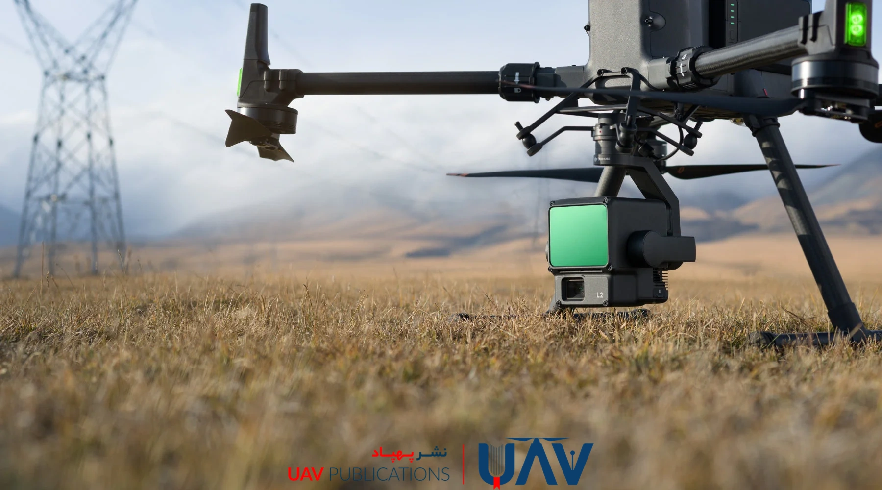
- High-Quality Imagery and Thermal Sensing: UAVs equipped with optical, infrared, and multispectral cameras capture detailed, real-time data.
- Low-Altitude Precision: Flying close to the ground yields finer resolution imagery than satellite platforms.
- Time and Cost Efficiency: Automated flight paths cover vast expanses rapidly, reducing reliance on ground teams.
- Reduced Human Risk: UAVs can operate in hazardous conditions, minimizing danger to personnel.
In natural resource contexts, these capabilities transform UAVs into invaluable assets.
Without the need for constant on-site presence, many environmental threats can be detected, monitored, and addressed proactively. The following sections explore specific applications of UAV technology in conservation and resource management.
UAVs in Environmental Monitoring
Effective environmental monitoring demands continuous, precise data on ecosystem health, species populations, and resource status. Traditional field surveys—while indispensable—are limited by incomplete coverage, adverse weather, and delays in data analysis. UAVs offer a modern, comprehensive alternative.
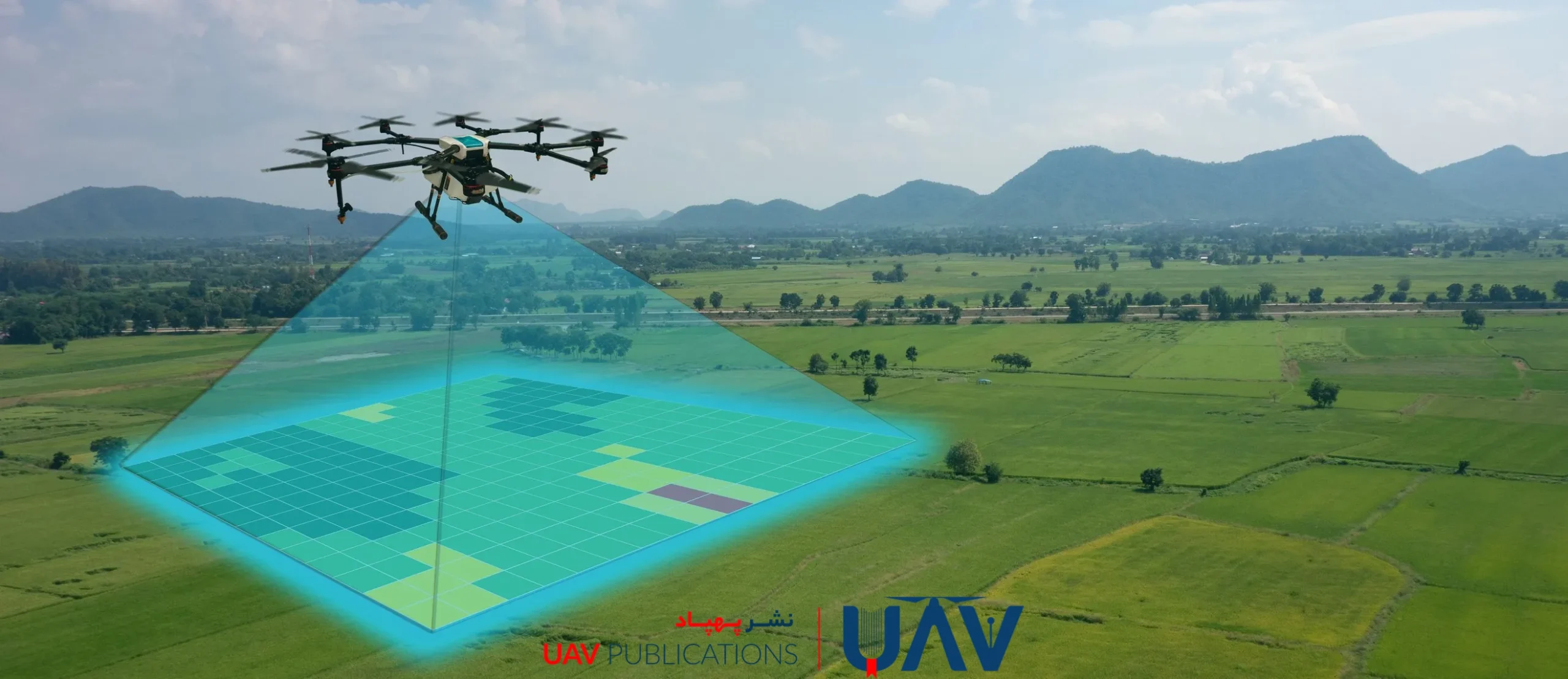
Equipped with advanced optical, thermal, and multispectral sensors, UAVs can conduct scheduled overflights of forests, rangelands, rivers, and other habitats to collect data that can be analyzed. They detect land-use changes, vegetation loss, sedimentation in waterways, and other ecological shifts. Their ability to fly repeated low-altitude missions makes them ideally suited for regional-scale monitoring—an especially crucial benefit in climatically diverse nations such as Iran, where seasonal variations demand agile data collection.
Detecting and Combating Wildfires
Wildfires rank among the most destructive natural disasters, inflicting severe ecological and economic damage each year. Human activities, drought, and climate change have heightened both their frequency and intensity. Rapid identification of fire outbreaks, accurate mapping of burn areas, and coordinated suppression efforts are therefore essential.
UAVs equipped with thermal cameras can pinpoint hotspots and incipient fire zones from a safe distance, delivering early warnings that prevent uncontrolled spread. During firefighting operations, they serve as aerial observers, providing real-time intelligence on wind speed, fire front progression, and critical flare-up points. Following extinguishment, UAV imagery facilitates a detailed damage assessment, informing restoration plans. Thus, UAVs not only prevent wildfires but also support the entire crisis-management cycle.
Tracking Wildlife Populations
Monitoring wide-ranging or elusive species—especially those that are rare, migratory, or endangered—presents significant logistical challenges. Conventional techniques such as camera traps, footprint surveys, and physical tagging are laborious, sometimes intrusive, and often yield incomplete data.
UAVs, equipped with high-resolution optical and thermal imaging capabilities, provide a non-invasive alternative. They can quietly survey animals from safe distances, document movement corridors, and record population counts without disturbing habitats. During migration or breeding seasons, UAVs minimize human-wildlife contact and reduce stress on sensitive species. The data gathered aids in precise habitat management, helping conservationists tailor strategies for deer, mountain sheep, waterfowl, and other wildlife.
Assessing Vegetation Health and Change
Vegetation cover is a crucial indicator of an ecosystem’s vitality. Whether degraded by drought, fire, or human activity, early detection of vegetation stress is vital. UAVs equipped with multispectral sensors measure vegetation indices, such as the Normalized Difference Vegetation Index (NDVI), to assess plant health. By comparing imagery from successive flights, managers can identify nascent deforestation or desertification hotspots and deploy restoration measures before large-scale collapse occurs. In this way, UAVs not only monitor but also help predict ecological trends.
Deterring and Documenting Illegal Poaching
Illegal hunting poses a severe threat to biodiversity. Poachers often operate under the cover of darkness or in remote locations, making human surveillance risky and resource-intensive. Thermal-capable UAVs can conduct nocturnal flights to detect unauthorized human presence, trace ingress and egress paths, and relay precise coordinates to ground teams.
High-definition video recordings serve as legal evidence, strengthening prosecution efforts. Early trials of UAV patrols in poaching hotspots have already shown reductions in illicit kills, safeguarding both ranger lives and wildlife populations.
Mapping and Monitoring Surface Water Resources
In arid and semi-arid regions, surface water bodies—such as springs, streams, and ponds—are vital for wildlife and vegetation. Climate variability, overgrazing, and pollution can undermine these sources. UAV surveys produce high-resolution aerial maps that track water levels, sediment buildup, and potential contamination zones. In mountainous or inaccessible terrain, UAVs deliver up-to-date data without the need for on-site inspection. Integrating UAV-derived imagery with GIS platforms yields precise water-resource inventories, aiding planners, conservationists, and local communities in sustainable water management.
Detecting Unauthorized Construction in Protected Areas
Illegal building—often through covert villa developments, road cuts, or boundary walls—threatens sensitive habitats. By regularly photographing protected landscapes, UAVs reveal land-use changes that elude ground patrols. Time-series comparisons document unauthorized encroachments, furnishing court-admissible evidence for enforcement actions.
Remote inspection also enhances ranger safety when confronting potentially armed offenders, allowing precise operational planning before any ground intervention.
Community Engagement and Environmental Education
Proper conservation transcends surveillance; it engages local communities as stewards of their environment. UAV-captured footage of habitat degradation or successful restoration projects makes compelling educational material. Presented in village workshops or school programs, such imagery fosters public awareness of how unsustainable practices—such as overgrazing, deforestation, or illicit burning—cast a long shadow over local livelihoods. UAVs thus serve not only as monitoring instruments but also as powerful tools for grassroots involvement.
Wildlife Census and Population Estimation
Accurate wildlife censuses are foundational to biodiversity management. Traditional counting methods can be costly, time-consuming, and stressful for animals. UAVs, flying silently at altitude, offer a noninvasive census technique. By capturing periodic aerial surveys of open habitats—such as grasslands, wetlands, and coastal zones—UAVs enable the statistical estimation of population sizes and distributions. In health assessments—such as identifying wounds, disease symptoms, or malnutrition—high-resolution imagery supports both ecological research and on-the-ground veterinary care planning.
Legal and Regulatory Considerations
Despite their advantages, UAVs face legal hurdles. In many countries, including Iran, regulations governing flight altitudes, privacy rights, data ownership, and liability remain vague or restrictive. Environmental agencies often require multiple permits, further delaying urgent monitoring missions. A clear, coherent legal framework that balances data protection and operational necessity is essential. Cross-sector coordination and training for UAV operators on legal protocols will underpin the sustainable adoption of UAVs.
Early-Warning Systems for Natural Disasters
Beyond routine patrolling, UAVs are integral to rapid-alert networks for floods, landslides, drought, and wildfires. Through scheduled flights over hazard-prone zones, UAVs detect shifts in soil moisture, ground cracks, rising water levels, or thermal anomalies—then alert authorities and local communities.
Coupled with AI-driven analytics, real-time UAV data can anticipate disasters, triggering preemptive measures that save lives, wildlife, and vegetation.
Documentation and Official Reporting
Scientific, continuous documentation of environmental conditions underlies sound policy, public support, budget allocation, legal enforcement, and education. UAVs produce timestamped photographic and video records that trace habitat degradation or recovery. Such visual evidence strengthens legal cases against violators and enhances performance reports for oversight bodies. Short documentary clips for broad audiences further democratize environmental knowledge, forging a cultural bridge between technology and community-based conservation.
Toward a Strategic, Future-Oriented UAV Integration
Collective experience underscores the unparalleled capacity of UAVs to revolutionize wildlife conservation and natural resource management. From remote monitoring and poacher deterrence to disaster warning and community education, UAVs have evolved from tactical tools to become core institutional assets. To realize their full potential, however, four pillars must be established:
- Legal and Institutional Frameworks: Enact clear UAV regulations that safeguard privacy, standardize data rights, and streamline permitting for conservation missions.
- Training and Capacity-Building: Empower rangers with technical skills in UAV operation, data analysis, and geo-spatial interpretation, in partnership with academic and research institutions.
- Public-Private-Community Partnerships: Engage NGOs, local communities, and citizen technologists to broaden UAV applications beyond government agencies.
- Sustainable Funding and Infrastructure: Allocate dedicated budgets for UAV procurement, maintenance, and software development to avoid ad-hoc, project-based constraints.